

Into the Blast Zone: A Day Exploring Mount St. Helens from Portland
Lava tubes, old-growth, and a crater-side picnic—an all-inclusive 12-hour escape from the city.
Fog hangs low over the Columbia River as the van slips out of Portland at first light, coffee steaming in hands, city grit giving way to moss and mist. The highway aims north, and Mount St. Helens waits—half mountain, half lesson plan—its story carved in ash, ice, and stubborn green. By the time you reach old-growth forest, the trees are already speaking in cedar spice and quiet drip. A guide cues the day’s rhythm: talk of plate boundaries and public lands, of an eruption that rewrote the map and a forest learning to breathe again.
Trail Wisdom
Two Light Sources for the Cave
Carry a headlamp plus a backup light; Ape Cave is dark, damp, and uneven, and redundancy is smart.
Layer Like a Local
Temperatures can swing 30°F between sunlit ridges and the lava tube. Pack a warm layer and light rain shell year-round.
Footing Matters
Wear sturdy hiking shoes with lugged soles; cave floors are slick and trails include roots and basalt steps.
Check Seasonal Road Status
High-elevation viewpoints like Windy Ridge typically open late June–October; verify USFS road conditions before you go.
Local Knowledge
Hidden Gems
- •Trail of Two Forests boardwalk for lava tree molds and kid-friendly exploration
- •Coldwater Lake’s boardwalk for calm water reflections and quick photo stops
Wildlife
Elk herds on the Pumice Plain, Mountain bluebirds along open ridgelines
Conservation Note
Stay on signed trails to protect fragile pumice soils and ongoing research plots; inside caves, avoid touching walls to protect delicate microbial communities.
The 1980 eruption removed over 1,300 feet from the summit and generated the largest landslide in recorded history, reshaping valleys and Spirit Lake in minutes.
Seasonal Guide
spring
Best for: Waterfall volume, Wildflower scouting
Challenges: Lingering snow at higher elevations, Unpredictable road openings
Rivers run high and lower trails glow with early blooms; higher overlooks may remain closed well into May.
summer
Best for: Crater viewpoints, Lava tube exploration
Challenges: Crowds at marquee stops, Strong sun and dust on exposed slopes
Prime access to Windy or Johnston Ridge with long daylight for stacked short hikes and a relaxed picnic above Spirit Lake.
fall
Best for: Elk sightings, Clear, crisp air
Challenges: Early storms, Shortening daylight
Cooler temps, golden alder, and quieter trails make autumn a sleeper hit—watch the forecast for early snow on NF roads.
winter
Best for: Solitude on lower forest routes, Snow-draped vistas from accessible pullouts
Challenges: Many monument roads closed, Icy conditions and limited services
The higher monument is largely snowbound; stick to lower-elevation forests and visitor centers if exploring independently.
Photographer's Notes
What to Bring
Sturdy Hiking Shoes or BootsEssential
Lugged soles provide grip on slick cave floors and rocky, sometimes dusty trails.
Headlamp + Backup LightEssential
Reliable illumination is crucial inside the lava tube; bring extra batteries.
Lightweight Rain Shell
Showers move quickly in the Cascades; a shell keeps you dry without adding bulk.
Warm Midlayer (Fleece or Puffy)Essential
Even in summer, the cave and shaded waterfalls are cool; a midlayer keeps you comfortable.
Common Questions
How much hiking is involved?
Expect several short hikes totaling 3–6 miles with 500–800 feet of cumulative elevation gain, plus uneven footing inside the lava tube.
Is the lava tube suitable for claustrophobic travelers?
Ape Cave is spacious in sections but dark and enclosed; those with severe claustrophobia may prefer to enjoy surface hikes and viewpoints instead.
Are food and water provided?
This all-inclusive tour typically includes a picnic lunch; always bring a refillable water bottle to stay hydrated throughout the day.
What about restrooms?
Trailheads and major viewpoints generally have vault toilets; there are no facilities inside the cave or on most trails.
Will my phone have service?
Coverage is spotty to non-existent within much of the monument and at high viewpoints—download maps and prepare for offline navigation.
Do I need any permits?
Guided travelers are covered by the operator. Independent visitors may need a Northwest Forest Pass at some sites and a timed-entry reservation for Ape Cave in high season.
What to Pack
Headlamp with backup batteries: the lava tube is pitch-black and damp. Sturdy hiking shoes: basalt, roots, and slick cave floors demand traction. Warm layer and rain shell: temperatures swing between cave, forest, and exposed viewpoints. 2 liters of water and snacks: stay fueled between picnic stops and hikes.
Did You Know
The 1980 eruption lowered Mount St. Helens’ summit by over 1,300 feet—from 9,677 to 8,363 feet—and produced the largest landslide ever recorded.
Quick Travel Tips
Reserve Ape Cave timed-entry in advance during peak season. Bring cash/card for an optional dinner stop on the return to Portland. Download offline maps—cell service fades inside the monument. Check USFS Road 99 and 25 status before your tour dates if exploring independently.
Local Flavor
Toast the day at Backwoods Brewing in Carson with a Loowit-inspired IPA if you return via the Columbia River Gorge, or stop at Loowit Brewing in Vancouver on the way back to Portland. For quick post-hike comfort food, Cougar Bar & Grill near the south side keeps it classic. Curious minds should detour to the Mount St. Helens Forest Learning Center to walk exhibits that connect the eruption to the present-day landscape.
Logistics Snapshot
Closest airport: Portland International (PDX). Primary trailheads/viewpoints: Ape Cave/Trail of Two Forests (south), Windy Ridge or Johnston Ridge (north). Drive time from Portland: 2–3 hours each way depending on route and road openings. Cell service: limited to none inside the monument. Passes/permits: Northwest Forest Pass at some sites; timed-entry for Ape Cave in high season; guided tours handle logistics.
Sustainability Note
This is a living research landscape—stay on designated trails, decontaminate footwear if you’ve visited other caves to protect bats from white-nose syndrome, and pack out all trash. Volcanic soils recover slowly; footprints off-trail can last for years.
Continue Reading
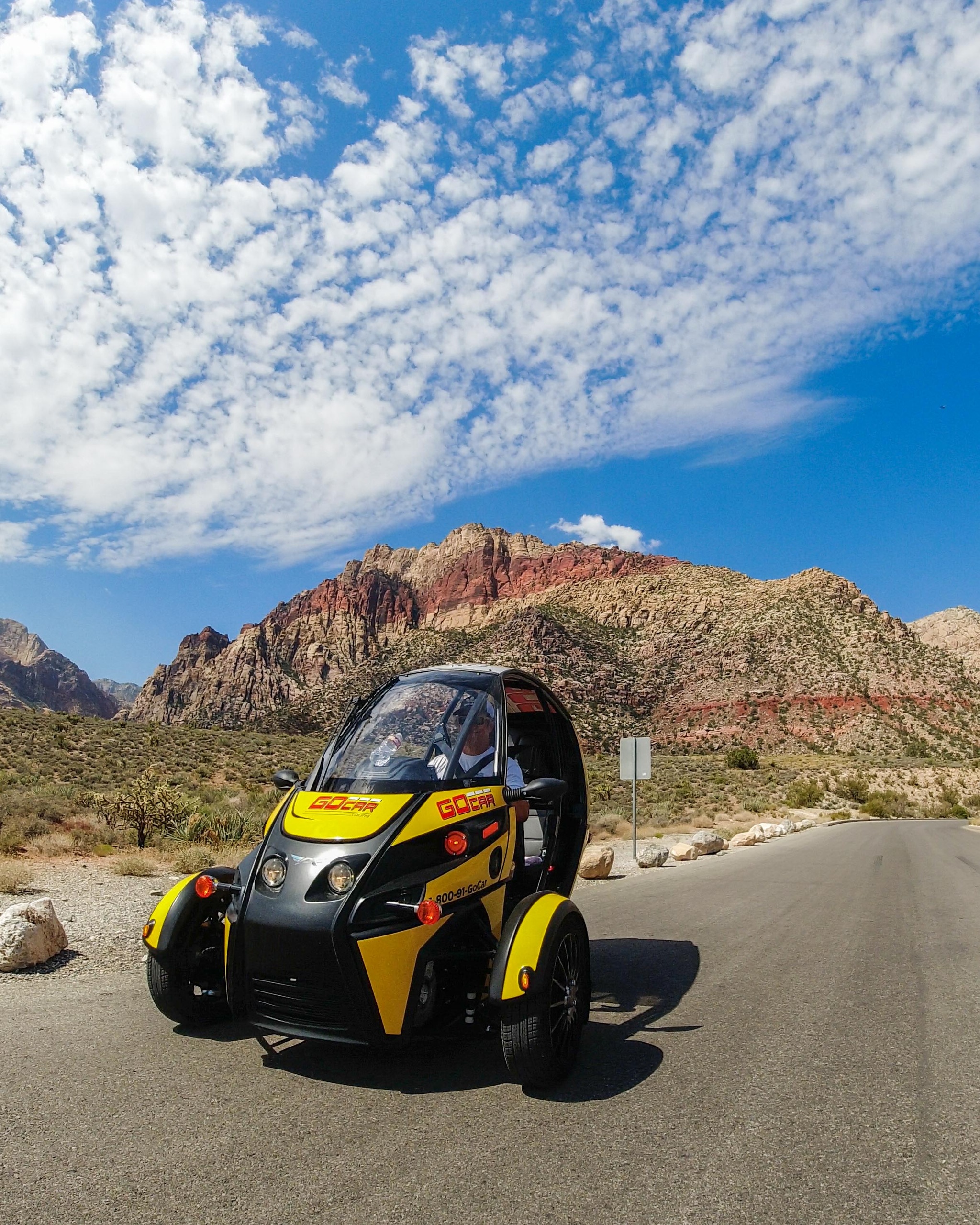
Wind in Your Hair: A Self-Drive Into Red Rock Canyon’s Scarlet Spine
Leave the Strip behind for a four-hour self-drive through Red Rock Canyon’s 13-mile Scenic Loop. In a compact GoCar with GPS narration, you’ll take in towering sandstone, sweep-view overlooks and quiet desert pulls—perfect for photographers, short-trip adventurers and anyone who wants to move slowly through dramatic landscape.
Las Vegas, Nevada

Vows a Mile High: Saying ‘I Do’ on the Grand Canyon Floor by Helicopter
Exchange vows on the canyon floor with a private helicopter, limo service, an officiant, and a professional photographer—an all-in package that turns geology into your wedding backdrop.
Tusayan, Arizona